Land Survey
Surveyed the banks, tops of banks, center of stream, and points of interest (ex: manholes, pipelines) along stream. A reference reach upstream of the site was also surveyed.
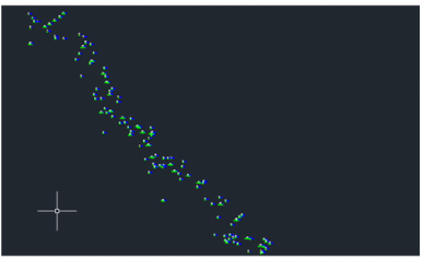
|
This is the data that was entered from the preliminary survey. Cross sections along the design and reference reaches were surveyed. Cross sections (Design and Reference) were entered into AutoCAD to perform calculations.
GIS Work
- GIS files obtained from Marcus Aguilar, a graduate student in the Civil Engineering Department at Virginia Tech.
- Files originally from the City of Roanoke
Soil Samples
Soil samples collected from streambanks. Sent to Virginia Tech soil testing lab but needs to be sent to Richmond for Nitrogen and Phosphorus testing.
